We have finalised the planting dates for this year and have taken the bold step to mix and match the days a bit. We have also opted to start planting a little earlier to avoid the wettest part of the year. The funding for these plants and the associated site preparation is through MELR, The Mahurangi East Land Restoration Project.
This year we propose two small mid-week planting days so hopefully that suits. These are on Grange Street and in Goodall Reserve. The other two days are on Te Whau walkway in the weekend.
The upcoming events (in the panel on this page) will be updated if and when any new information comes to hand. In the meantime, the first planting day is in less than a month on Thursday 2nd May.
We look forward to seeing you and can give you the latest gossip on trail development while we plant.
The AGM for the Mahurangi Trail Society will be held on Monday 9th October at the Betty Paxton Room in Snells Beach.
If you do not wish to attend and are a member please can you nominate someone who is attending as a proxy (or nominate myself or Hugh Briggs as secretary) so we can guarantee a quorum.
We attended the Clubs open day at the Warkworth Town Hall last Sunday. What a fantastic turn out. Maybe the inclement weather was a big help. I have decided to repost this from a few years ago as it sums up how you can get involved.
What can you do to help?
Contributions so far include;
20000000 combined hours from the committee
trail builders
trail maintainers
the loaning of equipment
managing contractors
scoping new trails
polishing the red tape of beauracy
donations of all kinds – money, materials, time.
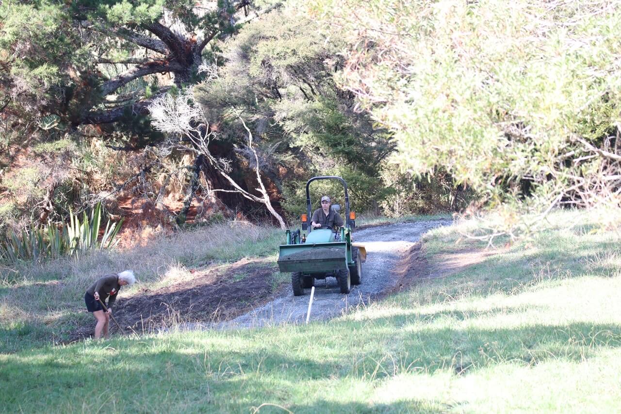
Young on the tractor not so young on the rake. Oh well. Photo Credit Shelley Trotter
In the future we need;
All of the above and
tree planters
pest controllers
weed exterminators
bird counters
volunteer coordinators
visionaries
administrators to manage the new beast called Mahurangi Trail Society
ecology evangelists and ecology soldiers
educators
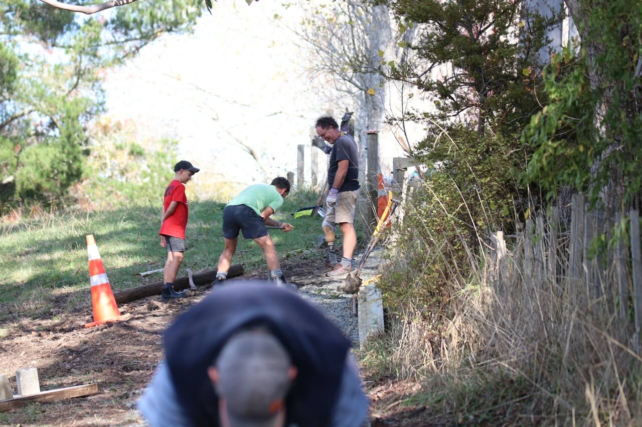
Hard at work at a recent working bee. Photo Credit Shelley Trotter
publicity coordinators
someone to make the morning tea for the volunteers
a photo person to record our labour’s and our successes
We will be having our AGM at the Betty Paxton Room in the community centre at Snells Beach on Monday the 10th October at 7pm. All are welcome. We originally planned to have the AGM on the 26th of September but have re-scheduled due to the national celebration of the death of Queen Elizabeth.
For more information please view the events page /whats-on/ where we will add the documents (Agenda, financials etc) as they are prepared.
We have taken the decision to postpone the planting planned for 3rd of July at Te Whau. We have had a number of challenges getting the site ready and with winter now upon us we want to give ourselves plenty of time as the weeds are currently winning the battle. We are looking at a date at the end of August at this stage. We will keep you posted.
In the mean time if you have the day free, TOSSI will be holding their planting day at Tawharanui Regional Park on July 3rd.
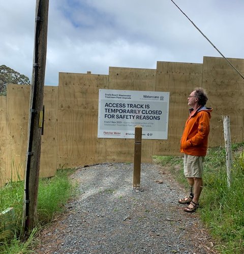
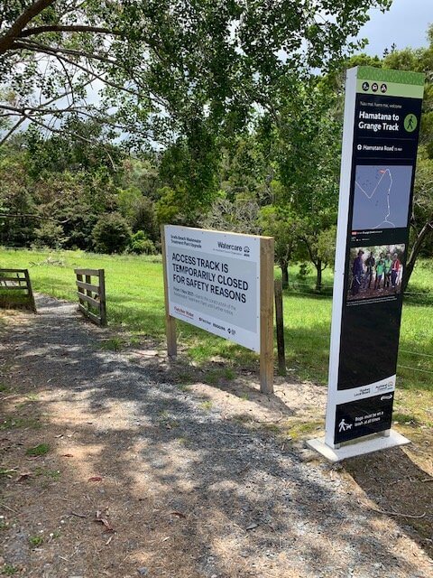
Watercare have come to life with vigour and new plans now that the lock down restrictions have eased. What this means for us and the Hamatana to Grange Street Trail is still a little uncertain due to their revised plans for the access road to the treatment plant.
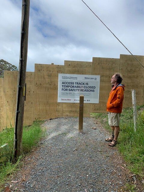
The access road to the treatment plant is undergoing the first of two significant upgrades. The current project is addressing the corners so they can move the very large trucks and loads that will be needed to be moved to construct the new treatment plant. To achieve this they are using quite large machines and that means that for site safety there can be no access to the public. The works are being undertaken by Brian Perry Civil and we had a wee chat with their project manager who was genuinely surprised at the level of use the trail had been receiving. He took the swift and pragmatic approach of installing a substantial barrier to protect the public from their activity.
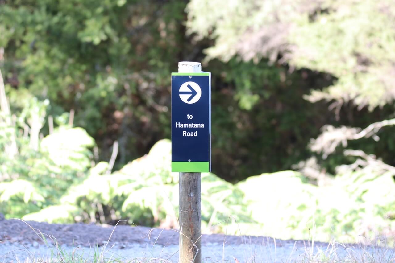
Grange St Entrrance
Barrier at Hamatana Road
We are working with Watercare now to ascertain what, if any, access can be made to Hamatana road after road the works are completed. We have plans in place with Watercare for the trail to connect to Goodall Reserve on a path that is off the road once the treatment plant upgrade is complete.
In the mean time the 450m or so of the trail starting from Grange Street will remain open. Please use this trail and enjoy the access to the stream and the local bird life.
Please respect the Watercare site, its signage and people and do not attempt to cross any barriers or jump any fences.
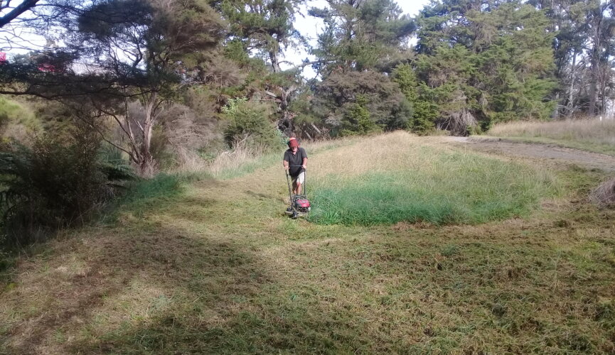
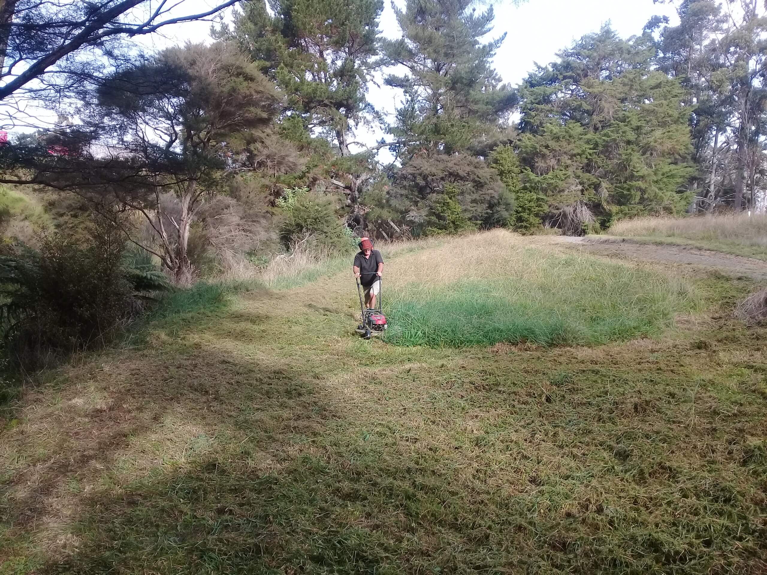
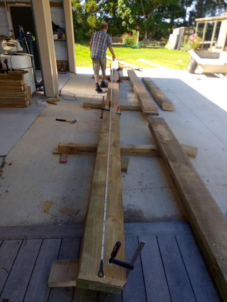
Quite a lot of work goes in behind the scenes and on stage in order to plant some trees. On the Grange Street Walkway we incorporated areas to be restored from grass into native vegetation as part of the design for the walkway. While we like the idea of forest canopy and good shade for the waterways, in a few areas we see real benefit in establishing a view corridor and access to the waters edge.
We are now preparing the planting for one such area. The planting day planned for June 19th has been on the map now for more than 2 years. In this time we have obtained permission from the landowner (DoC) and the neighbouring land owners. We have sought and received funding for the plants and have maintained the grass in anticipation of planting the area.
Site preparation, only 300 sqm to go.
Now in the final weeks counting down to the planting day, we have assessed the weed potential, in this case there is no kikuyu so no need to spray, and completed the first of two mowings to get the grass under control. Once the plants are in the ground we will keep an eye on the site and clear around any plants that are struggling. The longer grass that will be present by summer will help retain soil moisture for that all important first season. By this time next year we should see healthy plants that will out compete the grass.
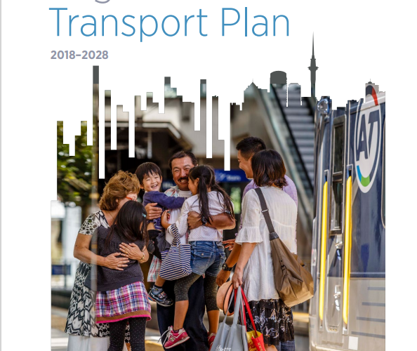
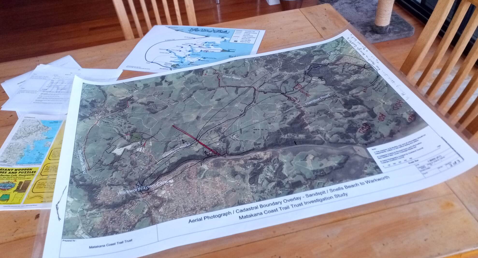
We have been working along side Matakana Coast Trail Trust to prepare a submission to the AT Regional Land Transport plan. This process has taken a considerable amount of time and effort.
Submission Process
We noted quite early on that the have your say feedback site made no provision for comments other than in response to the questions posed by AT. Once AT were made aware of that we were given an email address where these comments could be sent. You can email your submissions to daniel.mccabe@at.govt.nz
Our Submission
Our submission focusses on a few major points.
Auckland Council staff have not included the Pūhoi to Mangawhai Trail (which includes our proposed Snells Beach to Warkworth trail) in the RLTP and thereby completely failed to understand that:
It would provide genuine cycling commuter options for workers and students between Warkworth – Matakana – Snells Beach, all rapidly urbanising areas
It provides the most cost-effective option per km to grow Auckland’s cycling network
AT have failed to provide walkers and cyclists with a safe active mode transport option in Auckland most dangerous roading area thereby completely failing to live up Auckland’s Vision Zero Strategy
We request that Auckland Transport incorporates into the planning framework the following:
Mandatory consideration of connections for walking and cycling with all new subdivisions. This includes taking into account the proposed Matakana Coast Trail and the Rodney Local Board Greenways Plan for our area.
Proactive support from AT for ‘Corridor Security’ or ‘Creating Connectivity’ for all routes both on road and off road across multiple land tenures.
When support is requested by Matakana Coastal Trail Trust or the Mahurangi Trail Society, that request is given a higher priority it might currently have. We need your timely support in building a world class trail.
The ability to request timely expert advice on dealing with road-trail interfaces as these are identified. e.g.
where an off-road route crosses an existing road
where the trail may be in the road corridor
identifying locations suitable for bus stops or public transport access
The Matakana Coast Trail initiative is a low cost, low risk, highly deliverable opportunity that provides many beneficial outcomes to our local communities. The planned Matakana Coast Trail is so closely aligned with the objectives of the RLTP we urge you to include it officially in the RLTP. We will be attracting significant funding from alternative sources.
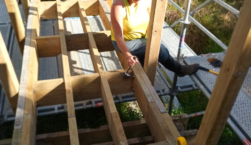
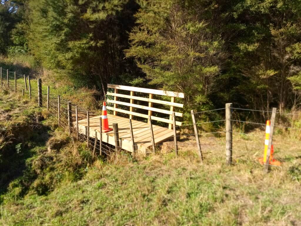
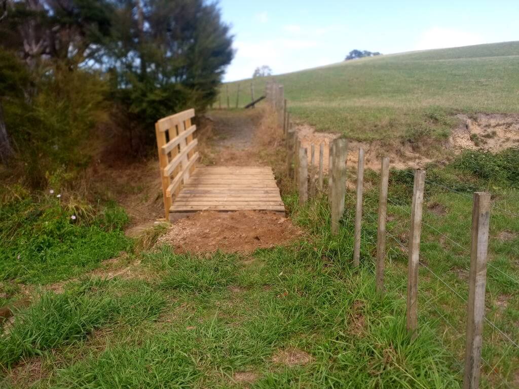
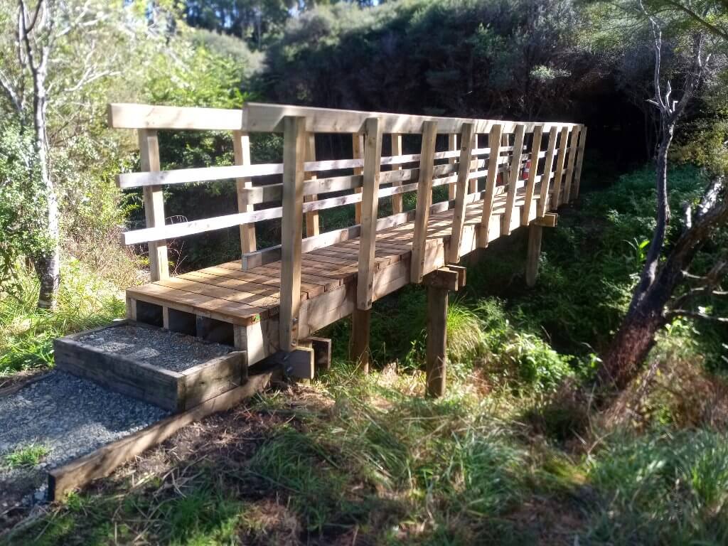
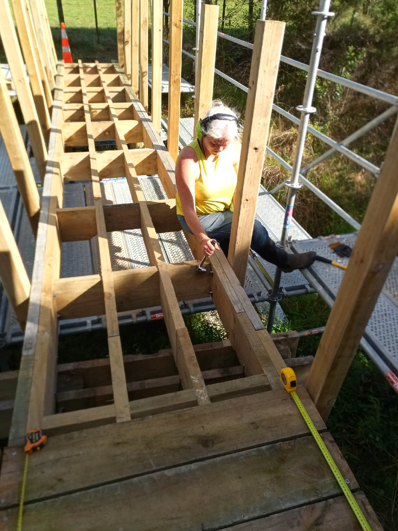
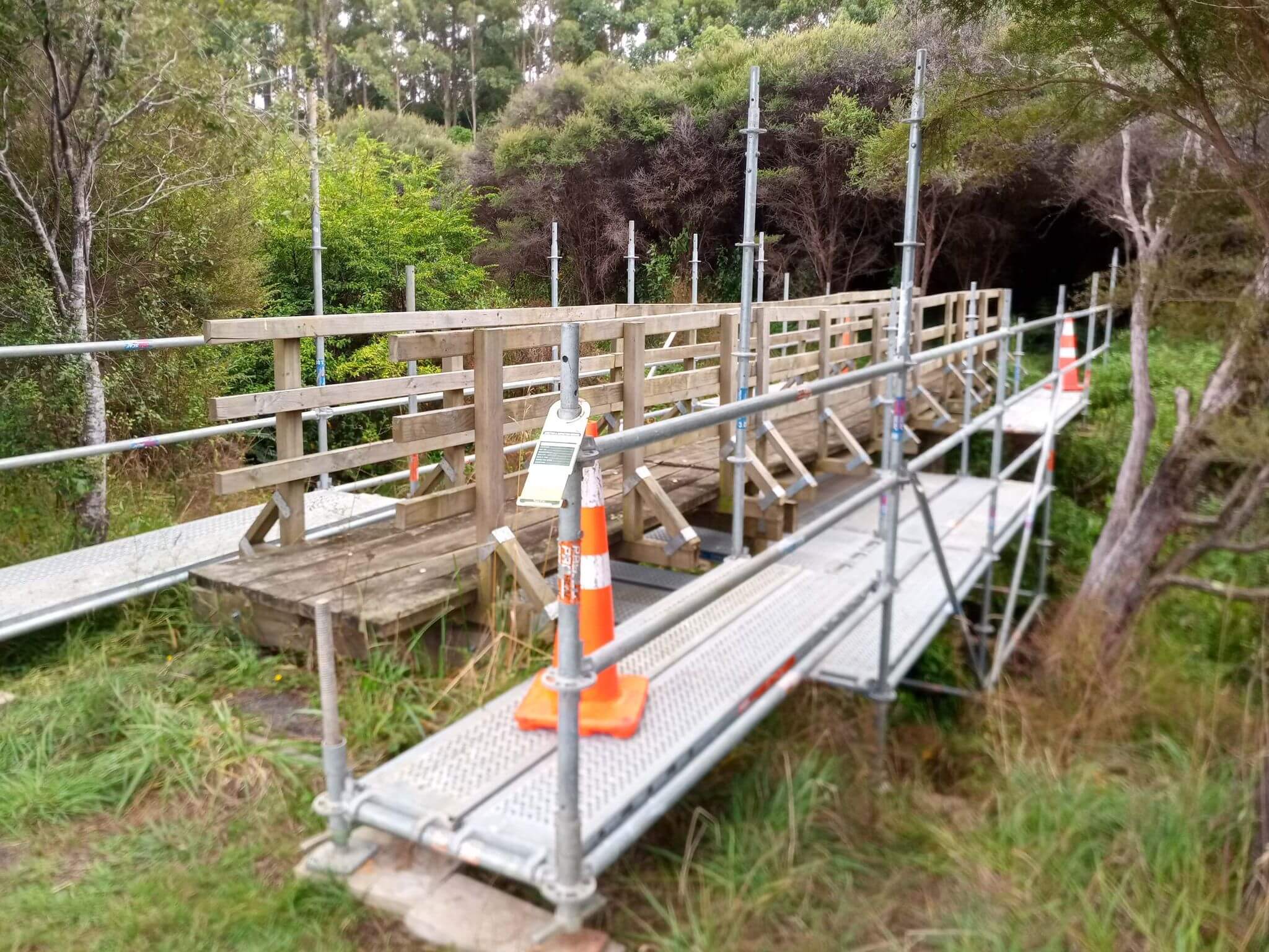
Regular users of the Farm Forestry Trail will have noticed the upgrades taking place to the boardwalk structures. These upgrades are part of a wider plan for ensuring the trail has enduring public access. Part of that process involves nominating a “controlling authority”, and in our case that is Auckland Council. When we spoke with Auckland Council about it, they were very keen however it became obvious quite quickly that our “Farm Race” standard structures would not be adequate to them. As a result we now have a series of nice new structures.
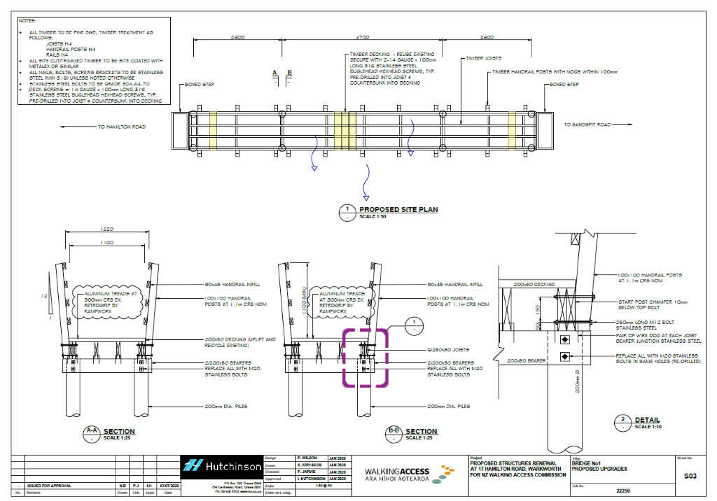
We therefore embarked on what we called the 4 Bridges project. This project is basically remediating and bringing each structure to the standard agreed with AK Council. We have received funding support from Matakana Coast Trail Trust and guidance and project support from the AK Council Community Facilities people. The Walking Access Commission are guiding us through the process of establishing the easements and all the legal stuff. We have had a significant amount of professional help from Hutchinson Consulting and have used standard designs where they exist. We also have managed to re-use a significant portion of the materials from the original structures.
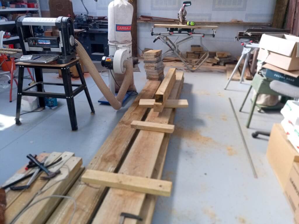
Kitset Bridges
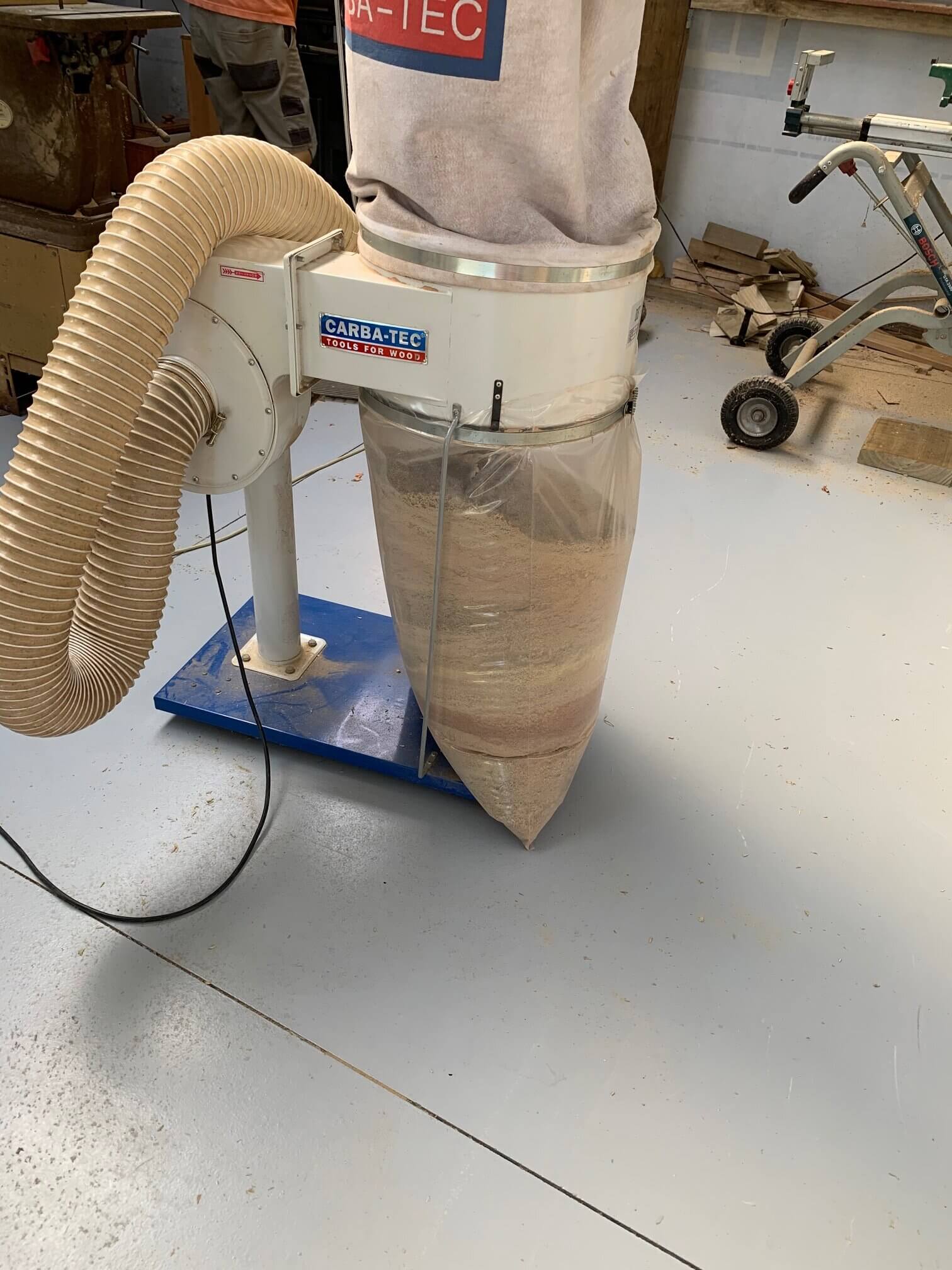
All of the structures were built as kitsets and test assembled in my workshop. This eliminated any risk of treated sawdust entering Duck Creek and simplified the over all construction process. Any assembly issues were identified and sorted in a safe environment. All of the on site work then became little more than carrying the pre-fabricated parts, bolting things together and screwing down the decking. As each structure was completed the recovered timber was brought back to the workshop and then re-purposed for the next structure.
DCB Design
Piles of parts.
Sawdust in chip collector
Measure twice..
Shelley installing hand rails
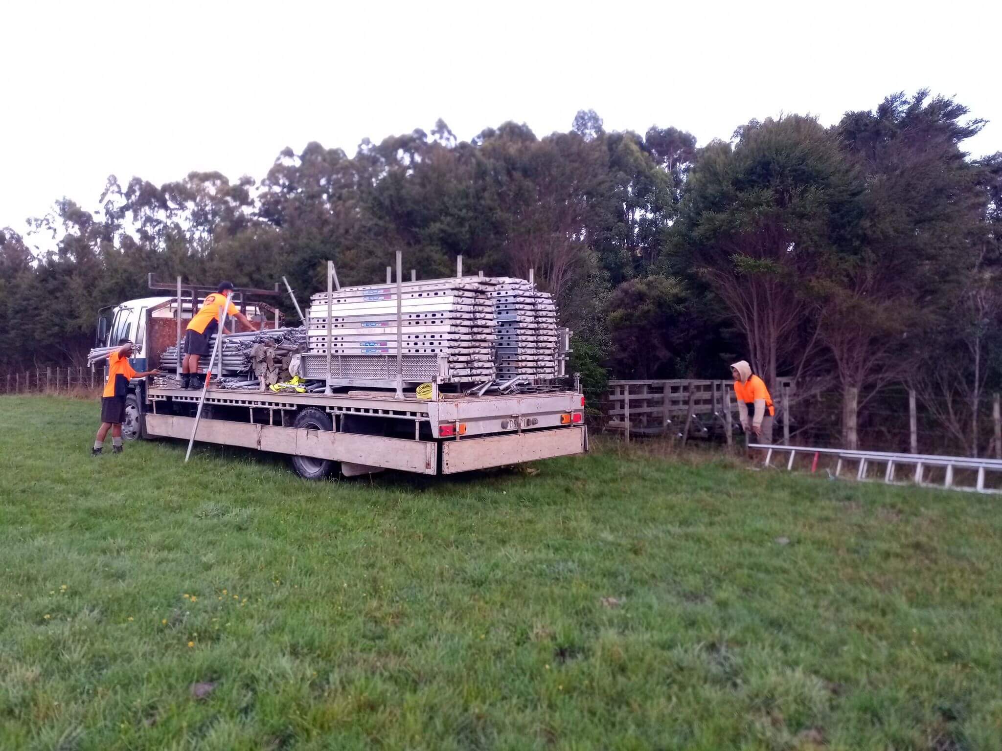
All of the labour except for the scaffolding has been volunteer labour. I continue to be amazed at the level of competency and motivation we have from our volunteer community. I must say thanks to Roger, Callum, Selwyn, Nyal, June, Shelley, Nick, Des and Al for your hard work and efforts. The fine people from Absolute Scaffolding made our large work area safe and productive. At the time of writing (with half a bridge to go) we have recorded over 220 hours of volunteer effort.
Absolute Scaffolding doing their magic
Scaffolding up around the old bridge
I must go now and organise some work on the last structure. There is a large pile of pre-cut timber waiting to be walked to site and screwed down.
In a past life my role was a Transmission Planner for Telecom Auckland. My job focus at the time was to plan the new fibre optic network that was to replace the old copper network to provide capacity for the new digital switches and more importantly, the 1992 Commonwealth Games. One of the things I needed to do was to present a picture of the proposed network to management so they could see that the network was robust, would serve the locations where the Games were to be, and to give them an idea of how much work there was needed to be done to make it real. To do this I ended up creating a network map, that looked a little like the London Underground map, that showed the various fibre routes and how nodes could back each other up. At the time all this was highly confidential information. The network at that stage was by no means perfect and the diagram showed the imperfections perfectly. Anyway, not long after presenting this lovely full colour diagram to management, a copy of it appeared on the T Shirts of the Telecom Auckland Team running the Round the Bays run. So much for it being confidential.
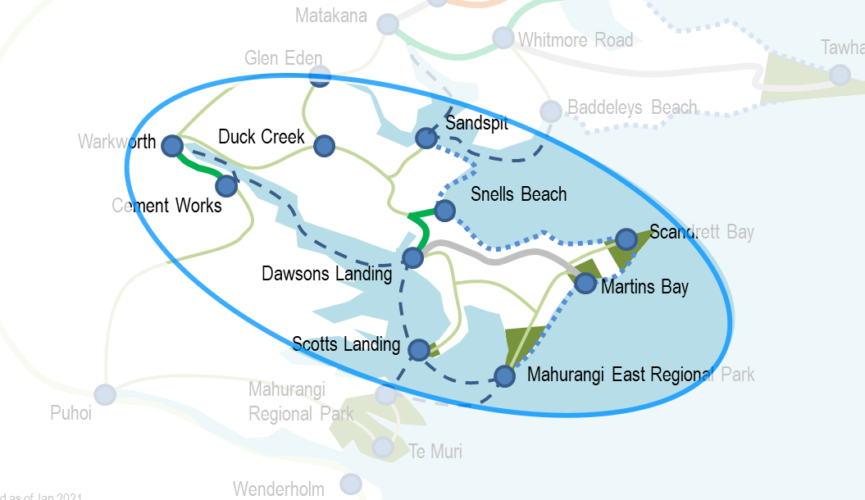
Shelley has been working on her vision of our area as being an interconnected set of regional parks. Anyone who has visited us will know that our table is always covered in laminated maps and the marker pens are never far away. Bold sweeping lines get drawn and rubbed out as the ideas and opportunities bubble to the surface.
Shelley’s Table
Recently we saw in the Local Matters an article and quite a detailed map of the proposed trails in our area and the wider region. Local Matters – Getting the trails on track. This map had been reproduced as a topologically correct map and the lines on the map, while aspirational, showed precisely where the trails are intended to go. Wearing my planner hat, showing this degree of precision presents a number of problems, not the least being if you draw a line on private land without permission from the landowner things can get very messy very quickly. Conversely if you leave a line out because we have not agreed precisely where it will go then we lose the integrity of the network as a whole.
It has become time to diagram the aspirational paths for our area on a more schematic style of map. We are working with MCTT to do this and I have a snippet of our area of the main map to illustrate what is being worked on.
Mahurangi Trail Society – Proposed Trails in context of a regional trail map.
Looking at the map above you will see that it has been distorted somewhat. It has been shrunk and stretched so that each major location is roughly the same distance apart. This distortion allows us to see the connectivity better. On the map Pakiri is very close to Te Arai and Scotts Landing is quite a way from Te Muri. In reality the opposites are true. Getting this distortion to work is not a trivial thing. Shelley is a geographer by training and in the early stages of drawing this I managed to get things to a state that was “geographically offensive”. Words like “The Mahurangi River runs North – South, not East – West” (actually there were a few extra words in that sentence that I don’t care to print) and motivating flying balls of scrunched up paper were a key part of the editorial process to get the map to its current state.
The lines are coded by their mode and status and the actual route of the line is correct in the most general sense. Again this allows us to think about the route without worrying which side of the fence it is on or other land related issues. This proposed map includes On Road routes, Routes by sea (i.e. water taxi or cruise services), Coastal Low-tide walks and of course Walking, Cycling and Bridleway routes. It is intended that users of the map be able to change the style of lines and points to highlight their part of the trial and use the image to support their trail projects.
The thing I like the most about drawing our proposed network this way is that it clearly highlights not only how big the trail network will be but how we all can do our own little bit to make it a reality. The map is in essence a working draft and will always remain so.