
We have a number of trail projects that we are working on.
Snells Beach to Warkworth
Our primary goal as a community group is to establish a walking and cycling trail that interconnects Snells Beach and Warkworth. Our preferred route, as of December 2019, utilises public and private land along the north shore of the Mahurangi River. The combination of a detailed environmental assessment with Barker & Co and the closure of Duck Creek Reserve due to Kauri Dieback has resulted in that part of this route becoming infeasible. We are now working with public and private land owners to secure a new route that avoids Duck Creek Reserve.
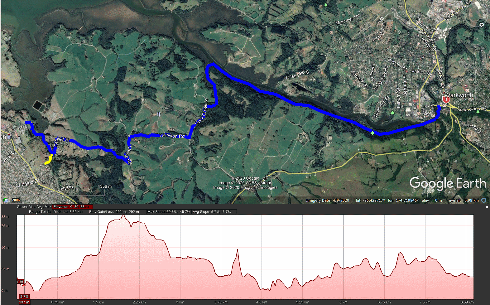
The total trail length is approximately 8.3km and will be constructed to a Grade 2 Walkway Cycleway standard.
Sandspit Road to Sharp Road
The Eastern boundary of Solway Deer Farm connects Sandspit Road to Sharp Road and bounds one tributary of Duck Creek. After logging some plantation pine trees approximately 800m of pathway has been formed, the final route to Sharp Road to be determined by the future connections.
MCTT Stage 1 Route Map
This is the working map for Stage 1 of the Pūhoi to Mangawhai Trail.