
In a past life my role was a Transmission Planner for Telecom Auckland. My job focus at the time was to plan the new fibre optic network that was to replace the old copper network to provide capacity for the new digital switches and more importantly, the 1992 Commonwealth Games. One of the things I needed to do was to present a picture of the proposed network to management so they could see that the network was robust, would serve the locations where the Games were to be, and to give them an idea of how much work there was needed to be done to make it real. To do this I ended up creating a network map, that looked a little like the London Underground map, that showed the various fibre routes and how nodes could back each other up. At the time all this was highly confidential information. The network at that stage was by no means perfect and the diagram showed the imperfections perfectly. Anyway, not long after presenting this lovely full colour diagram to management, a copy of it appeared on the T Shirts of the Telecom Auckland Team running the Round the Bays run. So much for it being confidential.
Shelley has been working on her vision of our area as being an interconnected set of regional parks. Anyone who has visited us will know that our table is always covered in laminated maps and the marker pens are never far away. Bold sweeping lines get drawn and rubbed out as the ideas and opportunities bubble to the surface.
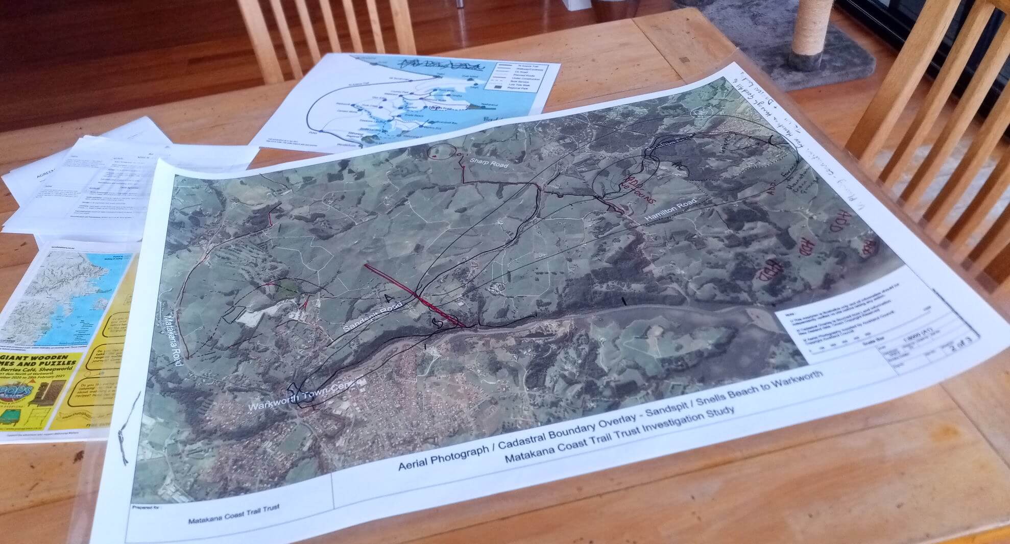
Recently we saw in the Local Matters an article and quite a detailed map of the proposed trails in our area and the wider region. Local Matters – Getting the trails on track. This map had been reproduced as a topologically correct map and the lines on the map, while aspirational, showed precisely where the trails are intended to go. Wearing my planner hat, showing this degree of precision presents a number of problems, not the least being if you draw a line on private land without permission from the landowner things can get very messy very quickly. Conversely if you leave a line out because we have not agreed precisely where it will go then we lose the integrity of the network as a whole.
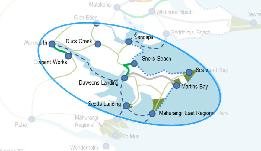
It has become time to diagram the aspirational paths for our area on a more schematic style of map. We are working with MCTT to do this and I have a snippet of our area of the main map to illustrate what is being worked on.
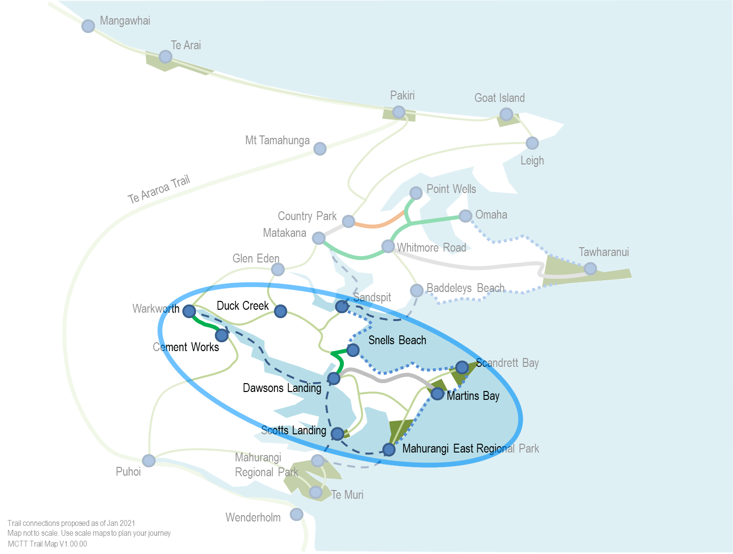
Looking at the map above you will see that it has been distorted somewhat. It has been shrunk and stretched so that each major location is roughly the same distance apart. This distortion allows us to see the connectivity better. On the map Pakiri is very close to Te Arai and Scotts Landing is quite a way from Te Muri. In reality the opposites are true. Getting this distortion to work is not a trivial thing. Shelley is a geographer by training and in the early stages of drawing this I managed to get things to a state that was “geographically offensive”. Words like “The Mahurangi River runs North – South, not East – West” (actually there were a few extra words in that sentence that I don’t care to print) and motivating flying balls of scrunched up paper were a key part of the editorial process to get the map to its current state.
The lines are coded by their mode and status and the actual route of the line is correct in the most general sense. Again this allows us to think about the route without worrying which side of the fence it is on or other land related issues. This proposed map includes On Road routes, Routes by sea (i.e. water taxi or cruise services), Coastal Low-tide walks and of course Walking, Cycling and Bridleway routes. It is intended that users of the map be able to change the style of lines and points to highlight their part of the trial and use the image to support their trail projects.
The thing I like the most about drawing our proposed network this way is that it clearly highlights not only how big the trail network will be but how we all can do our own little bit to make it a reality. The map is in essence a working draft and will always remain so.
So…. What colour T-Shirt would do you like?